Hyz Maps
Saved, self-contained interactive maps you publish from the workspace and share with named people.
Open Hyz MapsWhat a map is
A Hyz Map is a saved, self-contained interactive map — not a slideshow, and not a link back to your data. Publishing copies the layer bytes into it, so the map owns its layers, their styling, an opening view (centre, zoom, basemap), a bilingual title, tags and a member list.
Recipients get a live map: pan, zoom, toggle layers, legend, popups, measure — and nothing depends on the source data item still existing. Your maps live at /maps.
Creating a map
Maps are born in Hyz Workspace — there is deliberately no blank "new map" button.
- Build it in the workspace. Load layers, style them, run any analysis, frame the opening view.
- Publish it. Share → Publish to Hyz Maps, and give it a name. Layers upload one at a time.
- Finish it on its own page. Description and tags, Draft → published, invitations, viewer downloads.
To revise it, open Edit in workspace and save back in place — publishing again creates a second map.
Building on a data room
A map can be bound to one data room. Attach it and every item in the room becomes a layer, pinned at the version the room names — or the newest clean version when the room says "latest". Press Sync afterwards: new items arrive as layers, moved pins are re-copied, and layers whose data item left the room are listed for you to drop or keep. Detach unbinds the room and keeps the layers.
Live layers and copies
A layer added from a data item is live: the map reads the item's Hyz Layer — the same rows the item's services publish — so an approved field record or a Live Features edit shows on the map the next time it opens. The green live chip in the Layer sources panel says so. A live layer keeps working only while the reader may see the data item (the rule a data room already follows); it stores no bytes of its own.
A layer that carries copy is a sealed copy of one file version, made when it was added: it never changes under its audience, and it keeps working even if the item is later made private or deleted. Maps published before the live rule, layers uploaded from a file, tool results and layers pinned to a service revision are copies. Two actions switch a layer between the states on purpose — nothing switches silently:
- Switch to live turns a copy from a data item into a live layer (the item needs a Hyz Layer that is online);
- Save a copy freezes what a live layer shows now into a sealed copy inside the map.
Following the source
For a copy, the owner-only Layer sources panel names its origin — uploaded file, data item, or tool result — with its version. A newer clean version shows a v… available chip and an Update button. Tick Follow latest and the copy re-copies itself on every new clean version. Off by default: a map that does not move under its audience is the safer default. A live layer needs none of this — it is never behind.
Styling a layer
Open a layer's menu and choose Edit style. Five parts, scoped to that layer.
The basics
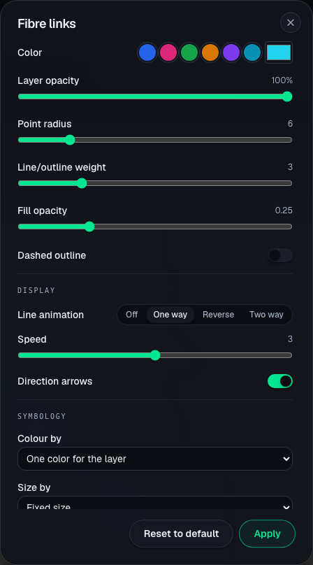
Color, Layer opacity, Point radius, Line/outline weight, Fill opacity, Dashed outline, plus Hatched fill for polygons and Heatmap (density) for points. Every plan.
Display
- Point icon — built-in glyphs (markers, buildings, utilities, transport, hazards), drawn on a plate in the layer colour.
- Icon by field — an icon per distinct value; unmatched values fall back to the layer icon.
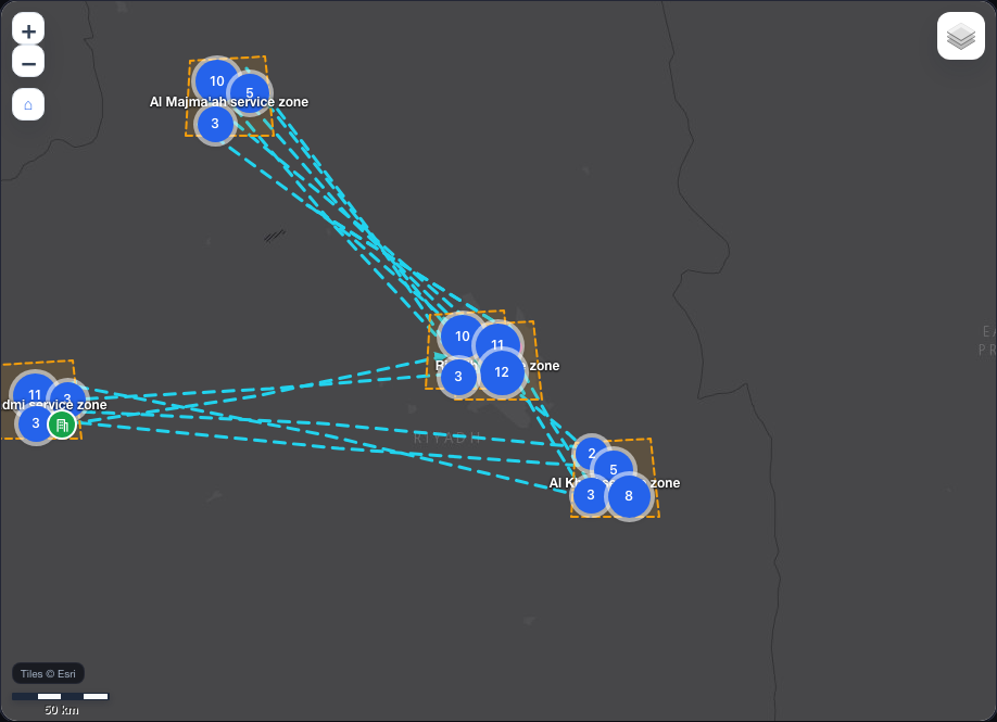
- Cluster points with a Cluster radius — nearby points merge into count bubbles that split as you zoom in.
- Line animation — Off, One way, Reverse, Two way, with Speed and optional Direction arrows. This is what makes a network read as a flow.
Symbology
Data-driven classification: Colour by a field (By category or Graduated, with a Classes count or a continuous ramp) and Size by a numeric field.
Symbology is the Enterprise line. On other plans those keys are stripped on save and you are told exactly which. The rest of the modal works on every plan.
Popup
Choose what a clicked feature shows: All attributes, Chosen fields (ticked in order, with a typed label to rename one), a Text template, or No popup. A Title field names the card.
A template is plain text with {field} tokens; new lines are kept, HTML is not — template and values are both escaped, so a popup cannot run script. Two switches opt in for http(s) values: Make web links clickable and Show image links as pictures.
Labels
Show permanent label, then Label field, Label size (S / M / L), Label color, a Label halo for imagery, and Show labels from zoom — a zoom level you pick, or Auto (by density).
Saved presets
The style dialog's Saved presets block saves the current style under a name — private to you, or public for anyone to pick — and applies a saved one to this layer. A preset that names a field this layer does not have offers to map it to one of your columns; anything left unmapped is dropped rather than guessed. Data-driven presets apply fully on the plans that allow classification and fall back to their base keys elsewhere. A Hyz AI proposal can be saved as a preset straight from its result.
Hyz AI on the map
Editors get a Hyz AI symbology panel. Describe the look you want; it proposes changes across every key above, plus layer visibility and renaming, the opening view and the basemap.
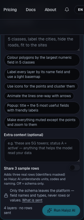
- Extra context (optional) — free text ("these are 5G towers; status A = active"), sent as written.
- Share 3 sample rows — off by default. Off, only the schema leaves the platform: field names, types, counts, ranges, never rows. On, three real rows per source go too, identifier-like columns masked.
- The answer is a preview on the live map: nothing is saved until Apply, and Discard restores the map exactly as it was.
- A key above your plan is marked Not on your plan before you apply, and again if the server drops it on save. Follow-up chips then suggest a next request.
What Hyz AI sees, and the daily allowance: /docs/ai.
Working inside a map
Owner and editors keep a live toolset inside a published map:
- Measure distance and area, snapping to layer vertices.
- Sketch points, lines, polygons and text onto a Sketch layer.
- Add sketch to "…", in the sketch layer's menu — the drawing joins that layer instead of standing beside it.
- Operations — buffer, dissolve, centroids, convex hull and simplify run for real on a layer here, spending your tool allowance like any workspace run.
- Save to map — sketches, results and dropped-in files are session layers, visible only to you until saved.
- Set as opening view stores the current camera and basemap.
- 3D hands the camera to a terrain view and back; a coordinate grid, basemap opacity, four basemaps (satellite, street, light, dark — Esri and OpenStreetMap) and a boundaries overlay are always there.
- PowerPoint captures the view as a one-slide deck; Present goes fullscreen.
Adding a sketch into a layer rewrites its geometry, so the layer becomes an uploaded copy and stops following its source data item. Your drawing is kept; the automatic refresh is not.
Static maps and service maps
Every layer on a map is one of two things. A service layer reads a service live — the layer you made from a data item with Make a service, added to the map without copying its bytes. A static layer is a copy of a file, sealed the moment it was added.
That decides what the map can do:
| Service map (every layer is a service layer) | Static map (any layer is a copy) | |
|---|---|---|
| View, style, share, print, file in the catalog | yes | yes |
| Build a dashboard on it | yes | no — the map says which layers are copies |
| Collect against it in Hyz Field | its editable services | no |
A map does not have to be a service map. A sheet to print, a picture to share — a static map is exactly right for those. When you do want a dashboard on it, make a service for the data item behind each copied layer and choose Switch to live in the map's Sources panel; the map becomes a service map with no other change. The Workspace tells you which layers would make a map static before you save it, and the map's facts always show its kind.
Sharing a map
Access is per person, by invitation — by email or username; someone without an account claims theirs on first sign-in.
| Role | Can |
|---|---|
| Viewer | Open, toggle layers, legend, popups, measure — plus per-layer GeoJSON download when Viewers may download layers is on |
| Editor | All of that, live: add layers, restyle, sketch, run operations, save to the map |
| Owner | All of that, plus members and roles, status, opening view, duplication and deletion |
Copy link appears once the map is published; it is the ordinary URL and still opens only for people with a role — a map you have no role on answers not found, never forbidden. Publishing to the Catalog makes a map readable by anyone signed in; a reader may also Use it, which builds them their own copy. Filing it into a project shares nothing unless the per-item toggle is on.
Exporting a sheet
Export PDF frames the live map on a page: size and orientation, a sheet title, notes and a classification line, exported as a print-ready sheet with its legend.
Enterprise accounts also get the layout designer — a multi-page report editor with a block palette, saved templates and a Hyz AI report writer: Print layouts & reports.
Limits
Map count, layers per map, layer data per map, editor invitations and data-driven symbology all follow your plan — see Plans & limits. Publishing needs a paid plan; building in the workspace does not.
Good to know
- A map's layers are copies. Re-versioning or deleting the source does not change the map; Update, Follow latest or Sync moves it.
- The sketch merge is one-way. A layer that absorbed a sketch no longer follows its data item.
- Deleting a map deletes its layer copies for every member. It never touches the source data item.
- Downloads are off by default for viewers; editors and the owner always have them.